

Many of the issues concerning Israel and historical Palestine involve geography; nothing helps more than good maps to improve understanding. In this section, we recommend sources of good maps covering the history, current status, and issues still in dispute regarding Israel and the region.
As with any "historical document" maps should be carefully evaluated. For example, the borders of the Palestine region prior to the British Mandate were undefined, particularly in desert regions with no settled population. The British Mandate from the League of Nations left borders subject to interpretation, leading to disputes that took many years to resolve including some not yet resolved. And there is no one map of the "Barak proposals in 2000" -- as various meetings were held, many proposals were made, modified, and revised so maps have to be carefully anchored in time and related to specific meetings and proposals. An earlier or later map may have offered more or fewer concessions from Israel.
This page was prepared in cooperation with Dr Motti Friedman and Gila Ansell Brauner of the The Pedagogic Center, The Department for Jewish Zionist Education, The Jewish Agency for Israel.
Israel and Palestine: Before 1948
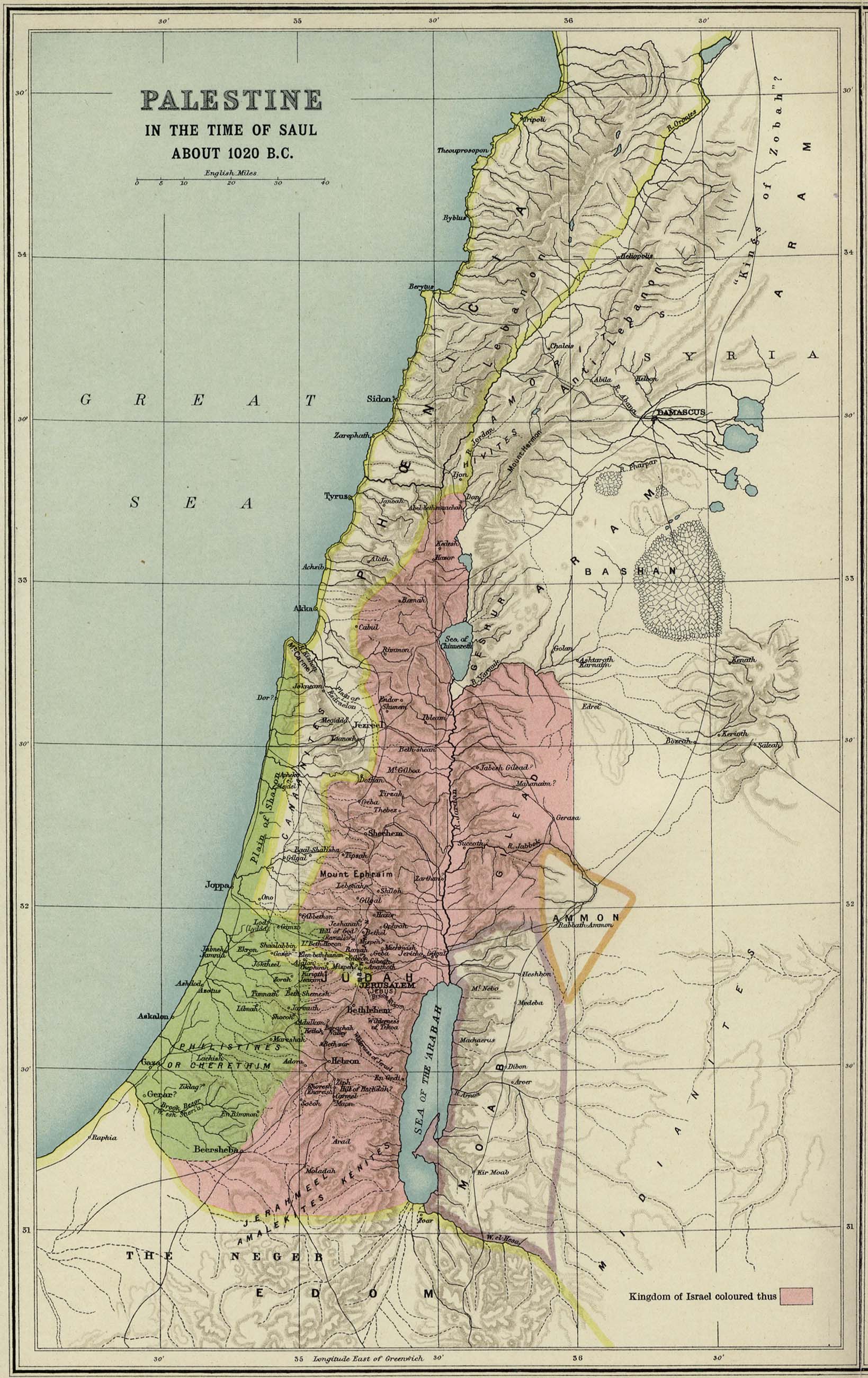
- Region of Palestine in 1020 BC, the Kingdom of Israel under Saul (1915 map)
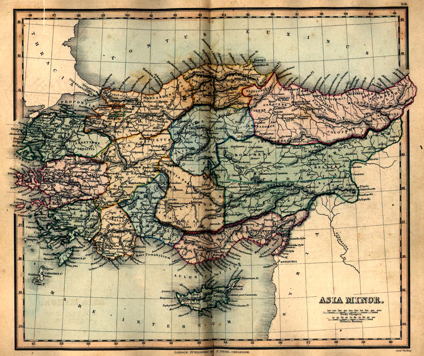
- Map of ancient Asia Minor, showing Syria as the entire region (1849 map)
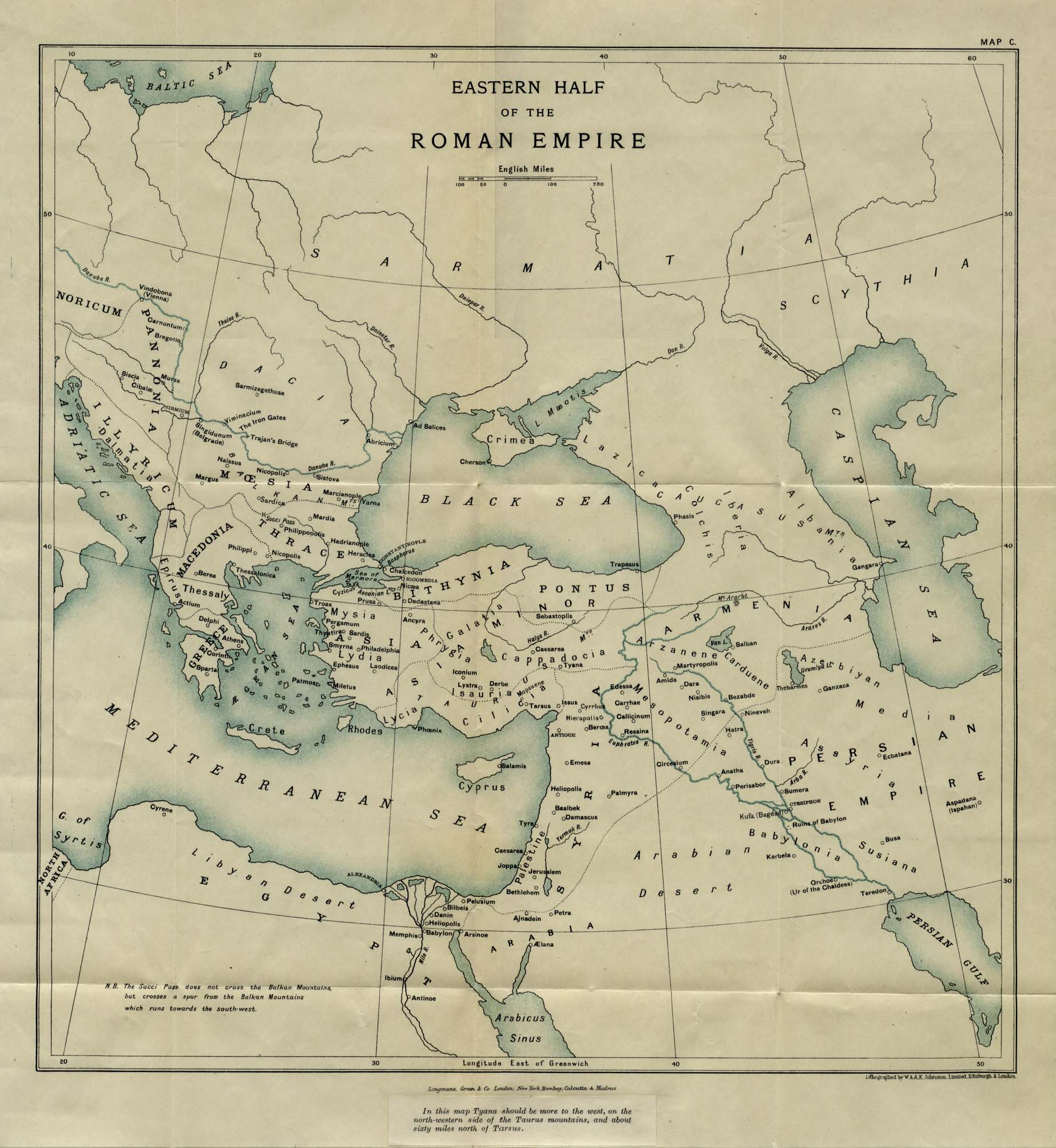
- Eastern Roman Empire map, showing Palestine region within Syria (1916 map)
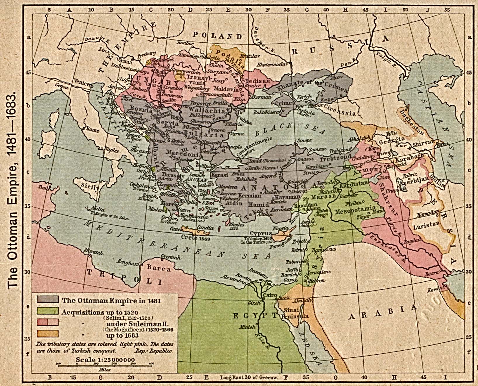
- Ottoman Empire, 1481-1683, showing Syria as the entire region (1923 map)
- Ottoman rule, on the eve of World War I
- The League of Nations Mandate for Palestine - 1920
- The British Alteration of the Mandate - 1923
- Peel Commission partition plan, 1937
- UN Partition Plan (September 1947)
- UN General Assembly Resolution 181 (November 1947) Palestine partition map
Israel and Region: 1948 to 1967
- Arab attacks on Israel, 1948
- Israel Armistice Lines 1949-1967
- Fedayeen Raids 1951-1956
- Sinai Campaign, 1956
- 1967 War
Israel and Region: Since 1967
- Ceasefire Lines Following the 1967 Six-Day War
- Disengagement Agreements Following the 1973 Yom Kippur War
- Israel 1993 - Borders and Ceasefire Lines
- Judea and Samaria showing Palestinian Authority Areas A & B - March 2000
- West Bank Final Status Map Presented by Israel May 2000
- Israeli Proposal to Palestinians and Syria July, 2000
- Final Status Map Presented by Israel at Taba, January 2001
- Security Incidents Map and Timeline (provided to AIPAC by israelinsider.com)
Satellite Images
Invalid Palestinian Arab Maps
 | Anti-Israel forces have made an industry out of producing invalid maps that either deny the existence of Israel altogether or distort the history and modern situation. This section presents a few examples. |  |
- Source: Palestinian Authority, State Information Service
- Source: pro-Palestinian Arab Website
- Source: Canadian pro-Palestinian Arab Website
Sources and additional reading on this topic:
- Hasbara Maps, The Department for Jewish Zionist Education, The Jewish Agency for Israel
- Israel in Maps, State of Israel, Ministry of Foreign Affairs
- Maps of Israeli Interests in Judea and Samaria, Begin-Sadat Center for Strategic Studies
- Israeli-Palestinian Interim Agreement Maps, State of Israel, Ministry of Foreign Affairs
- Map Room, Focus on Jerusalem
- A Land Divided, Time Magazine
- Palestine Boundaries 1833-1947, Archive Editions, publisher's description
- Maps of Israel, Jewish Internet Association
- Ancient Maps of Jerusalem, The Jewish National and University Library & The Hebrew University of Jerusalem
- Settlement Maps extracted from reports published by the Foundation for Middle East Peace